expedia
Outer Banks Self-Guided Driving Audio Tour

Outer Banks Self-Guided Driving Audio Tour

By Travel with Action
4 out of 5
Free cancellation available
Price is €23 per traveller* *Get a lower price by selecting multiple travellers
Features
  • Free cancellation available
  • 4h
  • Mobile voucher
  • Instant confirmation
Overview

Explore North Carolina's Outer Banks on this self-guided car tour. First, see the majestic Bodie Island Lighthouse and the peaceful Coquina Beach, where nature and history merge. Continue to Chicamacomico Life-Saving Station Historic Site, a maritime hero attraction. Next, see the Currituck Beach Lighthouse, a coastal landmark. Last stop: the Wright Brothers National Memorial, where flight dreams were realised. Explore maritime history and pioneering spirit in stunning coastal scenery.

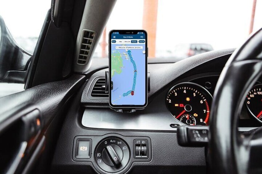
After booking, you can check your email before downloading the Tour Guide App by Action, enter your unique password, and access your tour. The preceding steps require good internet/wifi access. Simply follow the audio instructions and the route from there.

New, extra validity — now, it’s yours for an entire year! Use multiple times over multiple trips!

This is not an entrance ticket to attractions along the route. Check opening hours before your visit.

Activity location

  • Whalebone Junction Information Center - Outer Banks Visitors Bureau
    • Cape Hatteras National Park Road
    • 27959, Nags Head, North Carolina, United States

Meeting/Redemption Point

  • Whalebone Junction Information Center - Outer Banks Visitors Bureau
    • Cape Hatteras National Park Road
    • 27959, Nags Head, North Carolina, United States

Check availability


Outer Banks Self-Guided Driving Audio Tour in English
  • Activity duration is 4 hours4h4h
  • Opening hours: Mon 08:00-18:00
  • English
Language options: English
Price details
€23.06 x 1 Traveller€23.06

Total
Price is €23.06

What's included, what's not

  • What's includedWhat's includedEasy-to-use app: download Action’s Tour Guide App onto your phone
  • What's includedWhat's includedGreat value: purchase per car, not per person. More affordable than bus or guided tours!
  • What's includedWhat's includedEngaging storytelling: Uncover unique tales and thrilling history for a memorable journey!
  • What's includedWhat's includedPerfect narrator: nothing can beat listening to a great voice. Proven with tonnes of rave reviews!
  • What's includedWhat's includedOffline maps: no signal, no problem! Works perfectly without cellular or wifi.
  • What's includedWhat's includedComprehensive route and stops: See it all, miss nothing, leave no stone unturned!
  • What's includedWhat's includedGo at your own pace: Start anytime, pause anywhere, enjoy breaks for snacks and photos freely!
  • What's includedWhat's includedHands-free: audio stories play on their own based on your location. Easy to use!
  • What's excludedWhat's excludedAttraction passes, entry tickets, or reservations

Know before you book

  • Public transport options are available nearby
  • Suitable for all physical fitness levels
  • How to access: Once you book a tour, you’ll get a confirmation email and an instructions email. Follow the instructions right away: • Download the app • Enter the password • Download the tour • MUST DO while in strong wifi/cellular
  • How to start the tour: Once on-site, open the Action's Tour Guide App: • If there is just one tour, launch it. • If there are multiple tour versions, launch the one with your planned starting point and direction. • Go to the starting point. (Note: no one will meet you at the start. This tour is self-guided). • The audio will begin automatically at the starting point. If you face audio issues, visit the FAQ. • Stick to the tour route & speed limit for the best experience.
  • Amazing savings: • Driving Tours: Save money by purchasing a single tour for the entire vehicle, avoiding individual fees per person like on a bus tour. Connect your phone to the car speakers to share the audio.
  • Flexibility and Convenience: • Use the tour app anytime, on any day, and over multiple days. There's no expiration, making it perfect for revisiting on future trips.
  • Comprehensive Tour Experience: •The app provides a full itinerary, travel tips, narrated audio stories, scripts, images, videos, and recommendations for additional activities. • Enjoy a private experience without the crowds, ideal for personalised stops and photo opportunities.
  • Ease of Use and Accessibility: • The app is hands-free and activates stories via GPS, offering support through call, chat, or email. • There is no need for a continuous cell or Wi-Fi connection as the GPS map works offline.
  • Memorable Keepsakes: • Utilise the app’s images to create a photo book or share on social media, ensuring you have high-quality, crowd-free memories from your trip.
  • Preparation: • After booking, download the app and the tour using a strong Wi-Fi connection. • Review the tour at home before your trip for a better experience.
  • Starting the Tour: • Open the app upon arrival at your destination. • Select the appropriate tour based on your starting point. • Head to the starting location; the audio will begin automatically. • Follow the suggested route and adhere to the speed limit for an optimal experience. • By following these instructions and taking advantage of the app's features, users can enjoy a personalised, flexible, and in-depth exploration of their destination at their own pace and convenience.
  • In accordance with EU regulations about consumer rights, activities services are not subject to the right of withdrawal. Supplier cancellation policy will apply.

Activity itinerary

Whalebone Junction Information Center - Outer Banks Visitors Bureau
  • 10m
Welcome to The Outer Banks and Cape Hatteras National Seashore! This stretch of picturesque coastline is packed with stories of lost colonists, shifting sands, and of course… pirate ghosts! So let’s get started! Note: This 97-mile-long tour covers the essentials of the Outer Banks in 3-4 hours.
Bodie Island Lighthouse
  • 10m
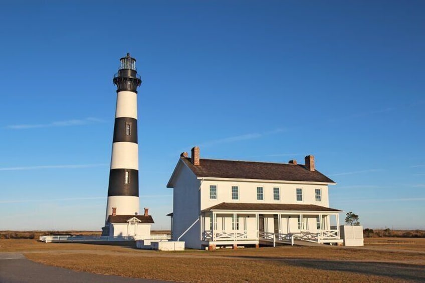
In 1921, the four-masted schooner Laura Barnes was sailing from Massachusetts to South Carolina to pick up a load of cargo. But the weather turned foul. A dense fog rolled in and the waves grew treacherous. Unable to see, the captain didn’t spot this shore… until it was too late! The ship crashed into the beach and broke apart. The entire crew made it out alive, but the ship stayed stuck! Salvagers scavenged most of it, but some of the ship’s remains are still lodged in the sand here to this day!
Oregon Inlet
  • 10m
In a few minutes we’ll cross over the Oregon Inlet. This waterway unites the Pamlico Sound with the Atlantic Ocean. And speaking of storms, it didn’t exist until 1846, when a huge hurricane hit! A ship called the Oregon was in Pamlico Sound during that storm. As the storey goes, the Oregon was sailing back to Edenton, North Carolina from Bermuda. It was right next to the Outer Banks when the hurricane hit. The rough, stormy seas lifted the entire ship up… and deposited it safely on a sandbar! Talk about luck!
Herbert C. Bonner Bridge
  • 10m
That huge body of water to the right of the bridge is the Pamlico Sound. It measures 80 miles long and about 18 miles wide, though it never gets any deeper than 26 feet! The rivers from the mainland flow down and into the sound too, creating the second largest estuary in the US, after Chesapeake Bay. The shallow water makes for some great fishing. Pamlico Sound is where 90% of North Carolina’s commercial fishermen catch their crabs, oysters, and clams!
Oregon Inlet Life Saving Station
  • 10m
Coming up on our left is the Oregon Inlet Life-Saving Station from 1874. It’s the only structure we’ll see when the bridge meets land again; you can’t miss it. Can you imagine being on a ship in the dark, trying to find a dock along this coast? Before there was radar, GPS, or sonar, sailors didn’t have an easy time navigating this cape or the Oregon Inlet. Shipwrecks were incredibly common. So common, in fact, that the Outer Banks earned the nickname “The Graveyard of the Atlantic.”
Pea Island National Wildlife Refuge
  • 10m
We’re now driving through 13 miles of nature preserve! It’s the Pea Island National Wildlife Refuge, and it stretches from the bottom of the Oregon Inlet to the northern border of the community of Rodanthe. And it’s part of what scientists call “the Atlantic Flyway.” This is a corridor that migratory birds use to travel up and down the coast, sort of like a highway in the sky! Birds use these beaches as pit stops along their way.
Pea Island Beach
  • 10m
Coming up in a moment will be parking for Pea Island Beach. This is a popular beach, but it’s so big you wouldn’t guess it! So even if you don’t go out in the water, take some time to sit on the sand and take in the gorgeous view.
Jughandle Bridge
  • 10m
We’re driving along Jughandle Bridge. But why does this bridge actually exist? After all, we’re not travelling from one island to the next, we’re just travelling next to the island!
Chicamacomico Life-Saving Station Historic Site and Museum
  • 5m
Off to our left is another life-saving station, the Chicamacomico US Life-Saving Station. Like the Oregon Inlet Life-Saving Station, this served as a hub for rescue crews to live, observe the coast, and conduct training exercises with the peculiar device known as a beach apparatus. But what on earth is that?
The Mother Vine
  • 5m
The Outer Banks are home to some fascinating pieces of history, but one of the most unusual can be found on Roanoke Island. It’s known as the Mother Vine, and it’s the oldest grapevine on the continent still producing grapes! The vine is about 400 years old, though no one is sure of its exact date of origin.
Kite Point
  • 5m
We’re approaching a little spot on our right that locals call “kite point.” It’s just a strip of sand beach, but it’s become a mecca for kitesurfing! The beaches near here have been popular with windsurfers since the 1970s. And Kite Point is the perfect spot to watch this high speed sport in action. But where exactly did kitesurfing come from?
Cape Hatteras Lighthouse
  • 5m
Do you remember that the Bodie Lighthouse was so poorly built that it leaned like the tower of Pisa? Well, you’re about to see the Cape Hatteras Lighthouse, and it had a tough time starting out too.
Cape Point
  • 5m
Cape Point in North Carolina isn't just a location; it's where nature and history meet. Its ever-changing sands and maritime stories connect visitors to a rich maritime heritage and the relentless shaping of the Outer Banks. Cape Point offers a unique blend of natural beauty and historical significance.
Hatteras
  • 5m
We’re entering the small village of Hatteras. If you love fishing, this little village is the place for you! Locals and visitors alike make their money and spend their free time with a rod and reel in their hands. It’s got a population of around 400 people, so it’s as quiet and as quaint as a small town can get. The roads snake and meander around with no grids and no official plots. Everything here feels connected to nature.
Teach's Lair Marina
  • 5m
We’re coming up on Teach’s Lair Marina. It’ll be the collection of boats off to our right in just a minute. As you’ve probably already guessed, the marina and plenty of other landmarks around here are named after Edward Teach, otherwise known as Blackbeard.
Hatteras Ferry Terminal
  • 5m
Soon after that, we’ll also see the Hatteras Ferry Terminal. From there, you can take a ferry over to Ocracoke Island, if you’re in the mood to see those horses or look for Blackbeard’s ghost. Ferries depart three or four times a day, depending on the season. You can walk or take your car on the ferry.
WWII British Sailor Cemetery
  • 5m
Do you remember the storey of all those German U-Boats sitting out in a line near the Outer Banks, blowing up any cargo ship that was trying to leave North Carolina? Well, what I didn’t tell you was that a few Allied forces were sent over from Europe to help battle those Germans here in North Carolina. Those who perished ended up here, at the WWII British Sailor Cemetery.
Jockey's Ridge State Park
  • 10m
In just a moment we’ll see huge sand dunes off to our left. Those belong to Jockey’s Ridge State Park, the tallest sand dune system in the Eastern United States! But why are there sand dunes in the middle of this island? Aren’t the islands themselves sand dunes? Well, scientists believe that over many years, storms and hurricanes wash sand inland. Meanwhile, the winds from the mainland blow in the other direction.
Wright Brothers National Memorial
  • 10m
To visit the Wright Brothers National Memorial, turn left onto Wright Memorial Drive. It’s got full-scale models of the brothers’ planes, markers of the distances of each flight the Wright Flyer took, and more.
Avalon Pier
  • 10m
If you’d like to visit Avalon Pier, turn right onto E. Sportsman Drive ahead. It’s a 440-foot-long wooden pier that has a fantastic view of the ocean and lots of restaurants and shops. The fishing is great from there too!
Wright Brother's Garage Monument
  • 10m
Want to see where the Wright Brothers built one of their earliest gliders? Like all great American inventors, they got their start in a garage! I’ll tell you where to turn in a moment to see the site of the garage where it all began.
Kitty Hawk Woods Reserve
  • 10m
We’re driving through the town of Kitty Hawk. You’ve probably heard the name before. After all, historians credit this town with being where Wilbur and Orville took their first flight. But technically, the brothers took their flight a few miles south of the town line, in a place called Kill Devil Hills. Quite a name, I know! Since that wasn’t an official town in 1903, Kitty Hawk gets the credit for Orville and Wilbur!
Duck Town Boardwalk
  • 10m
Coming up on our left is the Duck Town Park Boardwalk. This scenic park features waterfront trails, shops, restaurants, and more. If you’d like to visit and stretch your legs, turn left at the sign that says, “Town of Duck.” Otherwise, continue straight.
Pine Island Audubon Sanctuary
  • 5m
Coming up is the Pine Island Audubon Sanctuary, containing 2,600 acres of preserved land. This land is home to hundreds of species of birds, but it would have been home to many more if not for the hunting craze that took over this part of the Outer Banks over a century ago.
Corolla
  • 5m
We’re entering the town of Corolla. Off to our right, beyond the houses, stretches the seemingly infinite expanse of sand known as Corolla Beach. The locals here number around 500, but in the summer, the population surges into the thousands! Holidaymakers come here from all over to enjoy the small-town feel, the watersports, and that herd of wild horses.
Currituck Beach Lighthouse
  • 5m
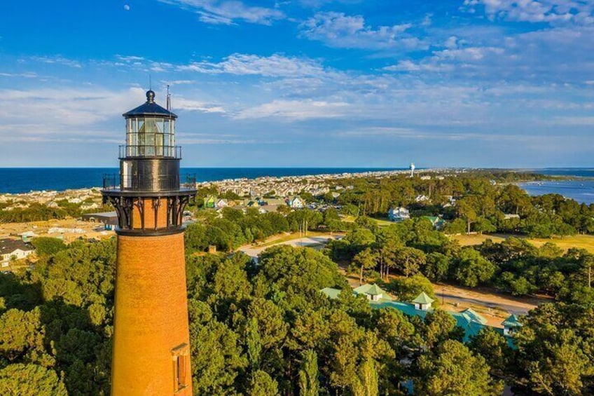
Currituck Beach Lighthouse is coming up in a few minutes. I’ll let you know when to turn if you want to see it. On December 1, 1875, engineers finished construction on this “first-order” lighthouse. “First order” means the biggest kind of lighthouse. The Fresnel lens at the top of the tower stands about eight and a half feet tall and stretches to around six feet wide! Its light can be seen from 21 miles away! The lighthouse itself stands 162 feet tall.
Whalehead Club
  • 5m
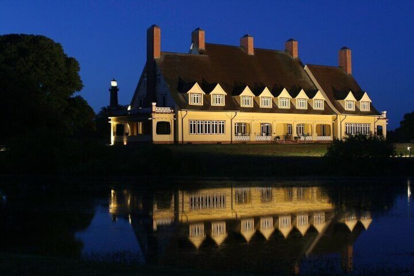
Just before the lighthouse, you’ll also have the chance to see the historic Whalehead Club. In the late 1800s and early 1900s, this area became the go-to place for wealthy Americans who wanted to do a little hunting. Edward Collings Knight, Jr. was heir to so many fortunes—sugar, railways, and steamships! And he and his second wife bought a huge tract of land here in 1920 and started building a house on it. The resulting house is called the Whalehouse Club. It’s a 22,000 square foot home designed in the Art Nouveau style. The Knights used it and offered it up to their friends as a hunting lodge.

Location

Activity location

  • LOB_ACTIVITIESLOB_ACTIVITIESWhalebone Junction Information Center - Outer Banks Visitors Bureau
    • Cape Hatteras National Park Road
    • 27959, Nags Head, North Carolina, United States

Meeting/Redemption Point

  • PEOPLEPEOPLEWhalebone Junction Information Center - Outer Banks Visitors Bureau
    • Cape Hatteras National Park Road
    • 27959, Nags Head, North Carolina, United States

Best Deals on Things to Do

Experience the wonders of the world up close with great deals on things to do near and far. Expedia offers one-of-a-kind activities that allow you to explore Nags Head your way. Whether you love nature, culture, food or a bit of adventure, we have the perfect activity for you.

Top experiences in Nags Head

With so many things to do in Nags Head, planning the perfect day out may seem like a daunting task. Expedia is here to take the hassle out of finding the best attractions, tours and activities in Nags Head. Families, couples and business travellers can all find the perfect activity in Nags Head to create life-long memories with the help of Expedia.