List your propertySupportTrips Learn about Expedia Rewards
Members save 10% or more on over 100,000 hotels worldwide when you’re signed in
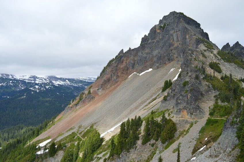


Ultimate Mount Rainier NP Self-Guided Driving Audio Tour
By Adventures with Action
4/5
4 out of 5Free cancellation available
Features
Overview
Activity location
Meeting/Redemption Point
Check availability
Ultimate Mount Rainier NP Self-Guided Driving Audio Tour in English
Language options: English
Price details
€13.83 x 1 Traveller€13.83
Total
What's included, what's not
Know before you book
- Public transport options are available nearby
- Suitable for all physical fitness levels
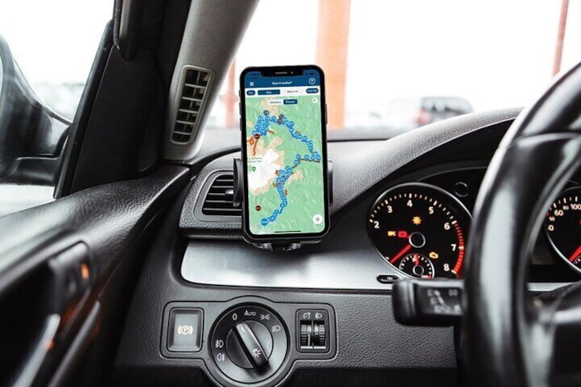
- How to access: Once you book a tour, you’ll get a confirmation email and an instructions email. Follow the instructions right away: • Download the app • Enter the password • Download the tour • MUST DO while in strong wifi/cellular
- How to start the tour: Once on-site, open the Action's Tour Guide App: • If there is just one tour, launch it. • If there are multiple tour versions, launch the one with your planned starting point and direction. • Go to the starting point. (Note: no one will meet you at the start. This tour is self-guided). • The audio will begin automatically at the starting point. If you face audio issues, visit the FAQ. • Stick to the tour route & speed limit for the best experience.
- Amazing savings: • Driving Tours: Save money by purchasing a single tour for the entire vehicle, avoiding individual fees per person like on a bus tour. Connect your phone to the car speakers to share the audio.
- Flexibility and Convenience: • Use the tour app anytime, on any day, and over multiple days. There's no expiration, making it perfect for revisiting on future trips. • Start and pause the tour at your leisure, accommodating breaks and side excursions without the pressure of keeping up with a group.
- Comprehensive Tour Experience: •The app provides a full itinerary, travel tips, narrated audio stories, scripts, images, videos, and recommendations for additional activities. • Enjoy a private experience without the crowds, ideal for personalised stops and photo opportunities.
- Ease of Use and Accessibility: • The app is hands-free and activates stories via GPS, offering support through call, chat, or email. • There is no need for a continuous cell or Wi-Fi connection as the GPS map works offline.
- Memorable Keepsakes: • Utilise the app’s images to create a photo book or share on social media, ensuring you have high-quality, crowd-free memories from your trip.
- Preparation: • After booking, download the app and the tour using a strong Wi-Fi connection. • Review the tour at home before your trip for a better experience.
- Starting the Tour: • Open the app upon arrival at your destination. • Select the appropriate tour based on your starting point. • Head to the starting location; the audio will begin automatically. • Follow the suggested route and adhere to the speed limit for an optimal experience. • By following these instructions and taking advantage of the app's features, users can enjoy a personalised, flexible, and in-depth exploration of their destination at their own pace and convenience.
- In accordance with EU regulations about consumer rights, activities services are not subject to the right of withdrawal. Supplier cancellation policy will apply.
Activity itinerary
Location
Activity location
Meeting/Redemption Point
Best Deals on Things to Do
Experience the wonders of the world up close with great deals on things to do near and far. Expedia offers one-of-a-kind activities that allow you to explore Ashford your way. Whether you love nature, culture, food or a bit of adventure, we have the perfect activity for you.
Top experiences in Ashford
With so many things to do in Ashford, planning the perfect day out may seem like a daunting task. Expedia is here to take the hassle out of finding the best attractions, tours and activities in Ashford. Families, couples and business travellers can all find the perfect activity in Ashford to create life-long memories with the help of Expedia.